
Sydney Culture: Sydney Festival 2027: The Create NSW supports
The Sydney Festival 2027 programme is being curated to showcase the best in contemporary and traditional arts, featuring international and local talent.
6 min read

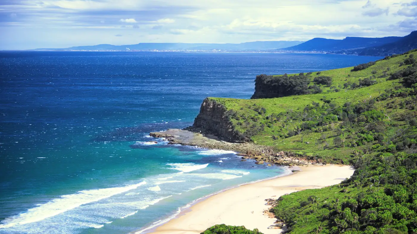
The Royal National Park coastal walk is a 29-kilometre route that runs from Bundeena to Otford along the clifftops, beaches and heathland of the Royal National Park.
Culture & Escapes Desk is a contributing writer covering culture and public affairs for The Sydney Times.
The Royal National Park coastal walk is a 29-kilometre route that runs from Bundeena to Otford along the clifftops, beaches and heathland of the Royal National Park. The walk is one of the most accessible long-distance coastal trails within an hour of the Sydney CBD, and it can be completed in a full day or split into two shorter sections using the park's internal road network to return to the starting point.
The walk begins at the Bundeena wharf, which is reachable by ferry from Cronulla. The ferry crosses the Port Hacking estuary and takes approximately 25 minutes, with services operating roughly every hour on weekends and every two hours on weekdays. Bundeena itself is a small village with a general store, a pub and a handful of cafes, and it serves as the most common starting point for the coastal walk because the return journey to Cronulla is straightforward by ferry or road.
From Bundeena, the track heads north along the shoreline past Jibbon Beach, a sheltered stretch of sand backed by low sandstone cliffs. The path climbs above the beach at Jibbon Head, where Aboriginal rock engravings are visible on the sandstone ledges. The engravings, estimated to be between 500 and 2,000 years old, depict whales, fish and human figures and are among the most accessible examples of rock art in the national park.
After Jibbon Head, the track follows the clifftop north through banksia woodland and heathland. The first major beach is Marley Beach, a long stretch of sand that is exposed to swell and rarely crowded. The beach has no lifesaving patrol and is subject to strong rips, so swimming is not recommended unless conditions are calm. The track continues past Little Marley Beach and then climbs to the sandstone headland that separates the Marley section from the Wattamolla catchment.
Wattamolla Beach is the most popular stopping point on the walk. The beach sits at the mouth of a freshwater creek that flows into a lagoon behind the sand, creating a natural swimming hole that is safe for most of the year. The national park operates a kiosk at Wattamolla during summer, selling coffee, snacks and hot food. There is also a large picnic area with tables, barbecues and toilets, making it a practical lunch stop for walkers doing the full distance in one day.
From Wattamolla, the track climbs steeply to the clifftop and continues north through coastal heathland. The vegetation changes as the walk progresses, with the dense banksia scrub giving way to open heath and then to woodland dominated by blackbutt and Sydney blue gum. The clifftop sections offer views back toward Bundeena and across to the Illawarra escarpment, and on clear days it is possible to see the outline of the Sydney CBD skyline to the north.
The final section runs from the Cape Solander viewpoint down to the Otford valley. Cape Solander is a popular whale-watching site during the annual migration between May and November, and the headland is managed by the NSW National Parks and Wildlife Service as a dedicated lookout. The descent from Cape Solander to Otford is steep in places, with a series of timber steps that can be slippery after rain. The walk finishes at the Otford train station, which is on the South Coast Line and has direct services to Waterfall and then to Sydney Central.
The Royal National Park coastal walk is graded as a moderate bushwalk, with some steep ascents and descents and uneven surfaces underfoot. Walkers should allow eight to ten hours for the full distance, including stops for lunch and rest. The track is well marked with yellow trail markers, but mobile phone reception is unreliable on the clifftop sections and walkers should carry a physical map or download the track before departure.
The NSW National Parks and Wildlife Service recommends carrying at least two litres of water per person, sun protection and warm layers, even in summer. The track is exposed to wind and sea spray on the clifftop sections, and the temperature can drop rapidly if cloud moves in from the coast. There is no drinking water available along the track, and the only formal campsites are at Bundeena and Otford, both of which require advance booking through the national parks website.
NSW National Parks and Wildlife Service information about the Royal National Park coastal walk, including current track conditions and safety alerts, is available at nationalparks.nsw.gov.au. Ferry timetables between Cronulla and Bundeena are published at transportnsw.info. Explore more coastal walks and getaways at the Culture & Escapes hub.
Direct inquiries, corrections, or documentation concerning this dispatch to our editorial newsroom desk.
The Sydney Festival 2027 programme is being curated to showcase the best in contemporary and traditional arts, featuring international and local talent.

With dates confirmed and Expressions of Interest open, the festival is already generating excitement across the arts community and among visitors.

The programme features productions at the Sydney Opera House, the Wharf Theatre, and the Seymour Centre, alongside independent venues across the city.

Vivid Sydney 2026 opens across Circular Quay and the CBD, featuring 90 light installations and projections from artists across five continents.